Thoughtfully tailored maps for web & app developers
Quick set up with an API key, no vendor lock-in, friendly support.
OpenCycleMap
Used by hundreds of applications and websites from around the globe, OpenCycleMap is an award-winning global map for cycling.
Transport
Chosen by OpenStreetMap for their front page, this map shows public transportation in great detail.
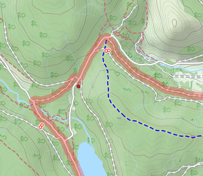
Landscape
A global style focused on information about the natural world - great for rural context.
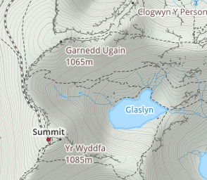
Outdoors
For all the outdoor enthusiasts - hiking, skiing and other activities.

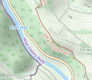
Atlas
A clear map style for both navigation and local context.
Transport Dark
A dark variant of the Transport map.
Custom maps with no fuss
Do you have a vision for your project that our standard maps don’t quite meet?
We’ll tailor a map style to your needs, from branding and custom icons to highlighting or removing specific features. We can adapt one of our own styles or help you migrate an existing map style.
As cartographers, we’re confident and quick about making changes. You can tell us the result you need and we’ll find the best way to get there.
Why Thunderforest?
We provide reliable, high-quality global maps that you can quickly set up and that your users will love.
We’re obsessed with detail. Labels are supplied in local languages and English so your end-users can find the information they need.
You can use one of our ready-made styles, overlay your own data, or ask us to create a custom style for you. Whichever option you choose, you’ll quickly get the map styles that you need.
Documentation and Tutorials
Easy integration with every map library that supports raster and vector maps
Thunderforest works with a huge range of options, from JavaScript, to Flutter, to native toolkits for almost every mobile platform.
There’s no proprietary SDKs or vendor lock-in. Our maps are easy to set up and run with your existing tech stack.
You’ll need an API Key to access all of our APIs and services, including: Map Tiles API, Static Maps API, Vector Styles API and Vector Sources API.
Get started today
Test out your ideas with our free plan. Paid plans from $125 per month.